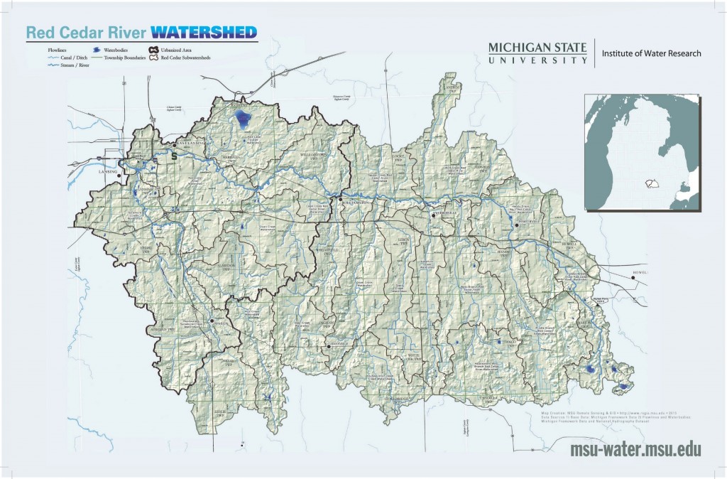
MSU calls the Red Cedar River Watershed home. A watershed is all of the land area that drains to a common body of water. The Red Cedar is a subwatershed of the Upper Grand River Watershed (view a full map of the Upper Grand here).
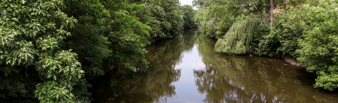
The Red Cedar River originates in Livingston County, flows north and then west for approximately 51 miles until it enters the Grand River in Lansing. The MSU campus is located within the urbanized portion of the watershed and about two miles of the river runs through MSU’s campus. The river is a thriving ecosystem and supports a variety of fish species and macroinvertebrates. Over 30 types of fish are found in the river, including bluegill, green sunfish, northern pike, largemouth bass and smallmouth bass. In 2013, the Michigan Department of Natural Resources stocked the Red Cedar with steelhead trout. Rare freshwater mussels have also been found in the Red Cedar by the Michigan Natural Features Inventory.
AT A GLANCE
STATE
Michigan
COUNTIES
Ingham, Livingston
LOCAL GOVERNMENTS
Fowlerville, Webberville, Williamston,
Okemos, East Lansing, Lansing
WATERSHED AREA
461 sq mi (1,194 km2)
HEADWATERS
Cedar Lake and surrounding area
Livingston County, Michigan, USA
42°31′03″N 83°58′42″W
MOUTH
Grand River
Lansing, Michigan, USA
42°43′29″N 84°32′53″W
RIVER LENGTH
51 mi (82 km)
LEARN MORE ABOUT WATERSHEDS
You can learn more about watersheds by downloading this brochure or by watching this short video.
WATERSHED MANAGEMENT PLANNING

As with most urban rivers, water quality problems exist. Pressures on the Red Cedar River include agricultural land use (upstream, in the headwaters and middle of the watershed) and urban development (downstream). High levels of E. coli bacteria have been found in the Red Cedar and multiple tributaries, which are used to indicate the presence of pathogens that make waters unsafe for wading or swimming. Click here to learn more about E. coli and how it is measured on the Red Cedar. Other portions of the watershed have degraded fish and macroinvertebrate habitat, caused by excessive sediment and low levels of dissolved oxygen. Dissolved oxygen is necessary for aquatic organisms to breathe underwater, and low levels will not support aquatic life.
A watershed management plan was developed to address these issues and other potential pollutants in the watershed. The plan was approved by the U.S. EPA in 2015. Over 20 local partners provided input into the plan, which was written by Michigan State University, Tri-County Regional Planning Commission and Streamside Ecological Services. Visit mywatersheds.org to learn about current efforts to protect the Red Cedar Watershed.